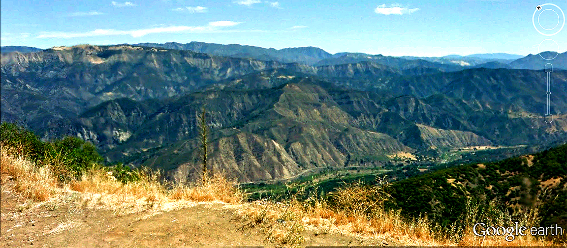
| Some of the great vistas in all of So Cal (AKA, Southern California) can be found in the Santa Ynez Mountains, which form the dramatic backdrop to Santa Barbara to the immediate north. A Google Earth street car perspective that I edited and processed through photoshop. Elevation here is 3,168 feet along the Camino Cielo, along the crest of the Santa Ynez Mountains directly north of Santa Barbara, California. The directional view is a little east of due north, situated 4.37 miles northwest of La Cumbre Peak--at an elevation of 3, 997 feet, the highest point in the Santa Ynez Mountains nearest Santa Barbara. Below is the Santa Ynez River valley (elevation 950 feet), and a wilderness region without permanent settlements stretches some 30 miles northward. |